Temperatures around Mecklenburg county began today - Wednesday - in the upper 60s, a sign of the high dew points in place. As this blogpost is written those values have risen into the low 70s, an uncomfortably sticky level. When the atmosphere holds this much water vapor it doesn't take much to trigger showers and storms, so guess what's in today's forecast? 😀
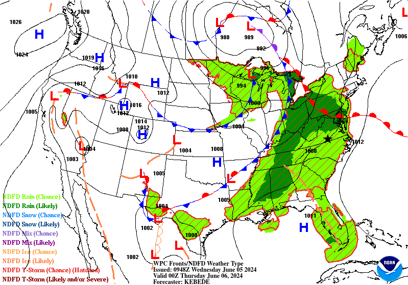
A warm front is positioned roughly along and parallel to I-64 in Virginia this morning. That boundary will be the focus of strong to severe storms this afternoon over the northern half of the state. Mecklenburg county will see some showers but no severe weather is expected. Given the soggy nature of the air, however, localized flooding could occur during any downpour.
Skies will be mostly cloudy today with afternoon temperatures topping out in the mid-80s. Winds will be out of the southwest at 5-10 mph, pumping even more stickiness into the county from the Gulf of Mexico source region. Showers will continue after sunset but the chances of thunderstorms will fade away with the loss of daylight.
This is the forecast surface weather map at 8 o'clock this evening (Mecklenburg county is at the black star):
No comments:
Post a Comment